Thirlmere West Road and Rough Crag
Updated: 21st May 2024
A section of the West Road at Thirlmere was temporarily closed beneath Rough Crag for safety reasons between 2021 and 2024, following storm damage. You can find out more here about the specialist engineering work we carried out to stabilise the crag so that the road could reopen in May 2024.
Rough Crag is around 100 metres in height with a 60 metre face sitting directly above the West Road. A number of mature trees growing from the crag were loosened during storms with the root plates lifting and dislodging the rock face behind. Some material fell down the face and onto the road, and a significant amount of loose material remained suspended directly above the road, presenting a major risk. A specialist project was needed to make the crag safe again.
Watch our video to see why Rough Crag was unsafe until our stabilisation work was completed
You can also use the link below to see the project plan we worked through.
TIMELINE OF ACTIVITYOur engineering teams are continuing to make good progress as they work to remove loose debris, rocks and trees from the face of Rough Crag. We expect to be finished ahead of the original 12 week estimate, and will have a more accurate timeline in the next couple of weeks. However, until the road is reopened, members of the public are urged to observe the signage and stay out of the fenced exclusion zone for their own safety. These photos show the large rocks and other debris which are regularly falling onto the road throughout the work. We thank everyone for their ongoing patience and cooperation.
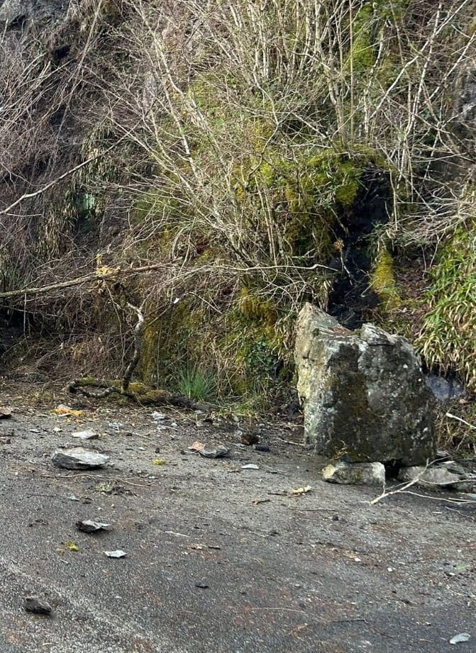
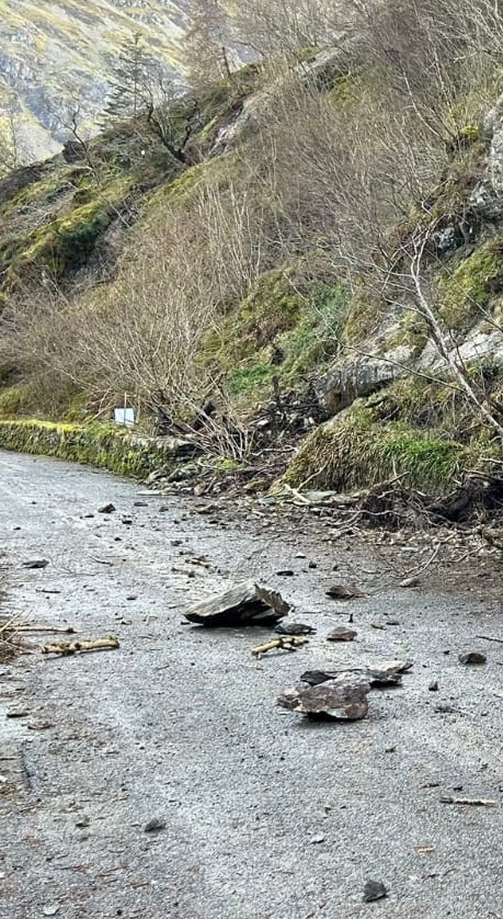
Works continues by our specialist contractors to remove trees and rocks. As can be seen in the photographs, debris is falling to the ground as a result of this work. We’ve had reports of pedestrians climbing fences to enter the working area during scaling activity. We would urge all people to respect the signs and barriers and stay safe.


Work has begun on the crag and specialist contractors are into their second week removing trees and debris, as can be seen in the first photograph on the left. The team is preparing to secure some of the boulders which are at high risk of falling and this 7.5 tonne boulder in the right hand photograph will be secured to the rock face with bolts and straps.


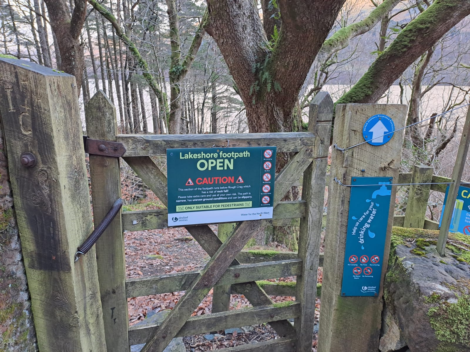 This week we were able to reopen the lakeshore footpath below Rough Crag, so walkers can now use this route to navigate a full circuit around the Reservoir. We’ve based this decision on the results of the surveys undertaken before Christmas which have given us reassurance that the footpath is safe for use.
We have started to develop the detailed plan for the mitigation works to make Rough Crag safe – this is a detailed study of all areas that require work, which will include tree removal, rock pinning and removal, de-scaling and debris removal. We are doing this in collaboration with Natural England to expedite the approvals process while ensuring that activities will preserve the unique status of the crag.
We will provide an updated plan and progress later in January.
Though the icy weather conditions have been challenging, specialist surveyors have spent all week undertaking a rope access and mobile platform inspection to undertake an assessment of the rock face on Rough Crag. Also our forestry team and contractors have finished the work to clear the road of fallen trees and debris.
We have also included an updated plan and are pleased to report that the plan remains on track with no changes to any of the dates.


 Our forestry team and contractors have been clearing the last group of pine trees which had fallen across the West Road. These were within the high risk section of road which is closed.
We are also felling and dismantling Ash trees which are infected with Ash Dieback, making them hazardous to the road and footpath.
We have completed those that were safe to do from the ground and our next step is to complete the work that can only be done using an elevated working platform similar to a cherry-picker.
 Engineering specialists accessed the top of Rough Crag via a safe walking route with one of our forestry team to carry out a 3D survey. They used a drone carrying specialised “LIDAR” (Light Detection and Ranging) equipment which uses pulses of light to accurately map the rock face in 3D. This will help to pinpoint exactly where all the cracks are in the rock face and identify any loose boulders or trees, allowing engineers to develop the best course of action to make the Crag safe.
The team also did a survey of the access routes up to the rock face so that the teams who will be carrying out the stabilisation work can do so safely.