Sheepfoot Lane
To create a more resilient region, we’ve committed to improving the health of rivers, lakes and waterways, helping to make the North West stronger, greener and healthier. That commitment includes major investment in our wastewater network and treatment infrastructure, so we can continue to reduce the frequency of combined sewer overflow (CSO) operations.
As part of our investment plans, we’re acting right now to improve water quality. See an overview below of the investment work which will be taking place in your area.
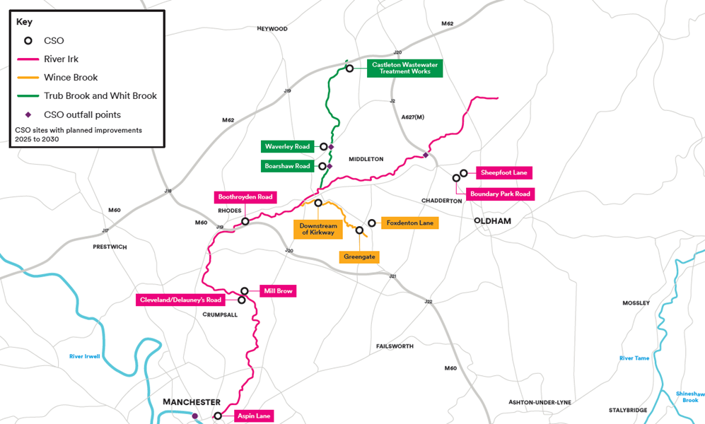
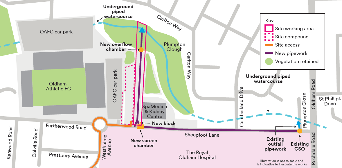
One of these projects is a £5 million-pound scheme in Oldham to enhance water quality in Plumpton Clough and the River Irk by reducing the number of times our storm overflows operate.
We’ll be working in the Coldhurst and Royton area to optimise and increase the capacity of our sewer network local to Sheepfoot Lane CSO. This will involve installing new pipework and equipment, building some storage chambers and changing the location of our existing outfall.
In January 2025, we held a community drop-in session to answer your queries and share information about the Sheepfoot Lane CSO. Thank you to everyone who came along to see us and provided valuable feedback which has helped to develop our plans and reduce the impact on the local community.
You can see the timeline of our works below
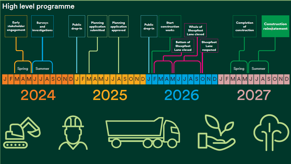
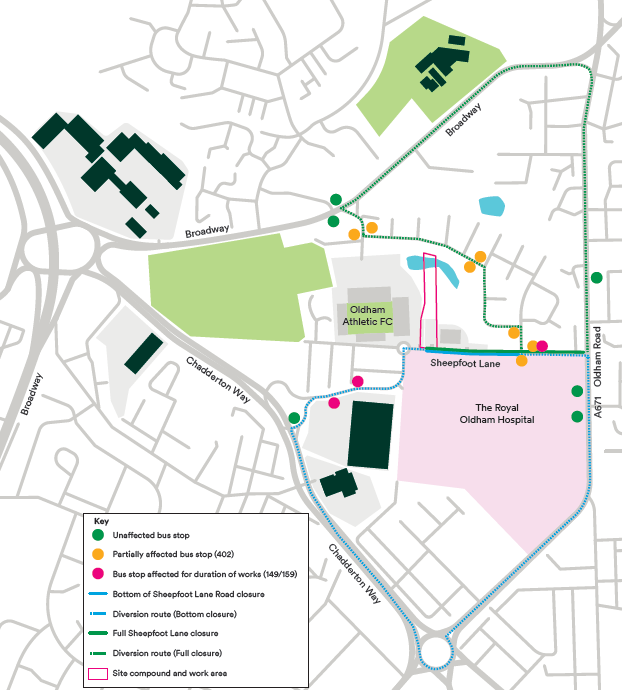
Based on the valuable feedback we received at our drop-in sessions, and working with Oldham Highways Team and Transport for Greater Manchester, we plan to split the closure into two phases, keeping the top of Sheepfoot Lane from the junction with Cumberland Drive open for the first few months.
In Spring 2025, we submitted a planning application to Oldham Council, with our proposal for a new outfall into Plumpton Clough Brook and were granted planning permission later in the year.
We started work in early 2026 and we appreciate your understanding and patience as we work to create an efficient and sustainable project that benefits everyone involved and improves the River Irk.
You can see more information about road closures in the map below.
We will update this web page accordingly with the latest updates. Thank you for your patience.